
Thank you for supporting this site ❤️
Make a donation
Make a donation
Gear up for your next adventure:
As an Amazon Associate, this site earns from qualifying purchases at no extra cost to you.
Montalto topographic map
Click on the map to display elevation.
Thank you for supporting this site ❤️
Make a donation
Make a donation
Gear up for your next adventure:
As an Amazon Associate, this site earns from qualifying purchases at no extra cost to you.
About this map
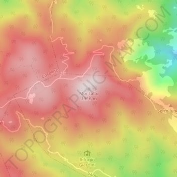
Name: Montalto topographic map, elevation, terrain.
Location: Montalto, Samo, Reggio Calabria, Calabria, Italia (38.15853 15.91990 38.15863 15.92000)
Average elevation: 1,707 m
Minimum elevation: 1,304 m
Maximum elevation: 1,934 m
Thank you for supporting this site ❤️
Make a donation
Make a donation
Gear up for your next adventure:
As an Amazon Associate, this site earns from qualifying purchases at no extra cost to you.