Geolocate

Ucedo topographic map

Click on the map to display elevation.

About this map

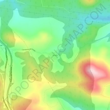
Name: Ucedo topographic map, elevation, terrain.

Location: Ucedo, Villagatón, León, Castilla y León, 24360, España (42.56823 -6.21354 42.60823 -6.17354)

Average elevation: 1,160 m

Minimum elevation: 1,050 m

Maximum elevation: 1,331 m

Gear up for your next adventure:

💧Hydration Pack - Hands-free hydration system for long hikes
💧Hydration Bladder - Hands-free hydration solution for long treks
🛌Insulated Sleeping Pad - Critical thermal barrier between you and the cold ground
🔥Camping Stove - Portable stoves to cook outdoors with ease
🥾Mountaineering Boots - Supportive boots for climbing and high-altitude hiking

As an Amazon Associate, this site earns from qualifying purchases at no extra cost to you.