
Pessamit topographic map
Interactive map
Click on the map to display elevation.
About this map
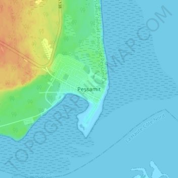
Name: Pessamit topographic map, elevation, terrain.
Location: Pessamit, Manicouagan, Côte-Nord, Quebec, G0H 1B0, Canada (48.91856 -68.66245 48.95856 -68.62245)
Average elevation: 6 m
Minimum elevation: -1 m
Maximum elevation: 38 m
Quebec trails, hiking, mountain biking, running and outdoor activities