
Sochi topographic map
Click on the map to display elevation.
Sochi
Sochi has a humid subtropical climate (Köppen climate classification Cfa), at the lower elevations. Its average annual temperature is 18.9 °C (66.0 °F) during the day and 11.5 °C (52.7 °F) at night. In the coldest months—January and February—the average temperature is about 10 °C (50 °F) during the day, above 3 °C (37 °F) at night and the average sea temperature is about 9 °C (48 °F). In the warmest months—July and August—the temperature typically ranges from 25 to 29 °C (77 to 84 °F) during the day, about 20 °C (68 °F) at night and the average sea temperature is about 23–27 °C (73–81 °F).
About this map
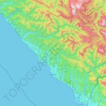
Name: Sochi topographic map, elevation, terrain.
Average elevation: 515 m
Minimum elevation: -3 m
Maximum elevation: 2,796 m
Other topographic maps
Click on a map to view its topography, its elevation and its terrain.