Geolocate

El Corraón topographic map

Click on the map to display elevation.

About this map

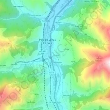
Name: El Corraón topographic map, elevation, terrain.

Location: El Corraón, Lena, Asturias, 33630, España (43.13653 -5.84439 43.17653 -5.80439)

Average elevation: 505 m

Minimum elevation: 275 m

Maximum elevation: 1,012 m

Other topographic maps

Click on a map to view its topography, its elevation and its terrain.

Río Huerna

España > Asturias > Lena

Average elevation: 1,041 m

Riospaso

España > Asturias > Lena

Average elevation: 1,115 m

Gear up for your next adventure:

🥾Waterproof Trail Shoes - Shoes designed to handle wet terrain
🎒Backpack Rain Cover - External shield to keep your entire pack dry
🛌Insulated Sleeping Pad - Critical thermal barrier between you and the cold ground
💧Filtered Water Bottle - Safe drinking water on the go
🩹Moleskin Blister Pads - Direct protection for painful foot pressure points

As an Amazon Associate, this site earns from qualifying purchases at no extra cost to you.