Geolocate

La Cabaña topographic map

Click on the map to display elevation.

About this map

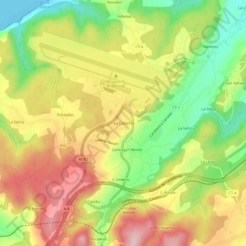
Name: La Cabaña topographic map, elevation, terrain.

Location: La Cabaña, Castrillón, 33459, Spain (43.53396 -6.04925 43.57396 -6.00925)

Average elevation: 110 m

Minimum elevation: 0 m

Maximum elevation: 214 m

Gear up for your next adventure:

🧦Hiking Socks - Moisture-wicking and comfortable socks for long hikes
👟Sport Hiking Sandals - Breathable footwear for water crossings and camp rest
🧦Hiking Liner Socks - Thin base layer to prevent friction and blisters
🦟Insect Repellent - Keep mosquitoes and black flies away in wooded areas
🦌Outdoor Trail Camera - Monitor wildlife activity near your favorite spots

As an Amazon Associate, this site earns from qualifying purchases at no extra cost to you.