Geolocate

Phaltan topographic map

Click on the map to display elevation.

Phaltan

Phaltan has an average elevation of 568 meters (1,863 feet).

Wikipedia (CC-BY-SA 3.0)

About this map

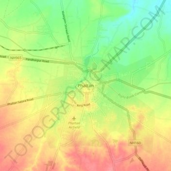
Name: Phaltan topographic map, elevation, terrain.

Location: Phaltan, Satara District, Maharashtra, 415523, India (17.95077 74.38988 18.03077 74.46988)

Average elevation: 561 m

Minimum elevation: 526 m

Maximum elevation: 594 m

Gear up for your next adventure:

🧥Insulated Jacket - Keep warm in cold outdoor conditions
🦶Anti-Blister Balm - Prevents friction and hotspots during long ascents
🥾Hiking Shoes - Durable and comfortable shoes for trail hiking
Camping Coffee Maker - Brew fresh coffee anywhere on the topographic map
Lightweight Backpacking Tent - Compact tent for efficient hiking trips

As an Amazon Associate, this site earns from qualifying purchases at no extra cost to you.