
Make a donation
Gear up for your next adventure:
As an Amazon Associate, this site earns from qualifying purchases at no extra cost to you.
Loburn topographic map
Click on the map to display elevation.
Make a donation
Gear up for your next adventure:
As an Amazon Associate, this site earns from qualifying purchases at no extra cost to you.
Loburn
The Loburn-Ashley fault zone is located from the northern banks of the Ashley River through to about Hodgsons road in the north, it runs parallel to the Ashley river. The Loburn fault, which runs along the south side of Hodgsons Road, is responsible for various terraced abandoned stream channels, wedge structures and scarps, notably Round Hill. The topography in Loburn is generally flat with gently rolling hills, altitude gradually decreases southwards from the foothills.
Make a donation
Gear up for your next adventure:
As an Amazon Associate, this site earns from qualifying purchases at no extra cost to you.
About this map
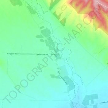
Name: Loburn topographic map, elevation, terrain.
Average elevation: 110 m
Minimum elevation: 60 m
Maximum elevation: 253 m
Make a donation
Gear up for your next adventure:
As an Amazon Associate, this site earns from qualifying purchases at no extra cost to you.