Geolocate

Lincoln Park topographic map

Click on the map to display elevation.

About this map

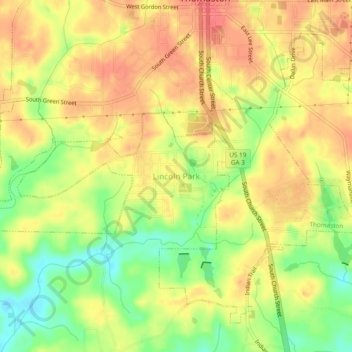
Name: Lincoln Park topographic map, elevation, terrain.

Location: Lincoln Park, Upson County, Georgia, 30287, United States (32.84791 -84.35047 32.88791 -84.31047)

Average elevation: 211 m

Minimum elevation: 174 m

Maximum elevation: 235 m

Other topographic maps

Click on a map to view its topography, its elevation and its terrain.

Thomaston

United States > Georgia > Upson County

Average elevation: 214 m

Gear up for your next adventure:

🧊Insulated Water Bottle - Keeps drinks cold in summer and prevents freezing in winter
🥾Waterproof Hiking Boots - Essential footwear for rugged terrain and wet Canadian trails
🦶Hiking Shoe Insoles - Added support for high arches and long days on feet
🧭Orienteering Kit - Tools for map reading and navigation in the wild
Camping Groundsheet - Protect your tent from moisture and dirt

As an Amazon Associate, this site earns from qualifying purchases at no extra cost to you.