
Thank you for supporting this site ❤️
Make a donation
Make a donation
Gear up for your next adventure:
As an Amazon Associate, this site earns from qualifying purchases at no extra cost to you.
El Volcán topographic map
Click on the map to display elevation.
Thank you for supporting this site ❤️
Make a donation
Make a donation
Gear up for your next adventure:
As an Amazon Associate, this site earns from qualifying purchases at no extra cost to you.
About this map
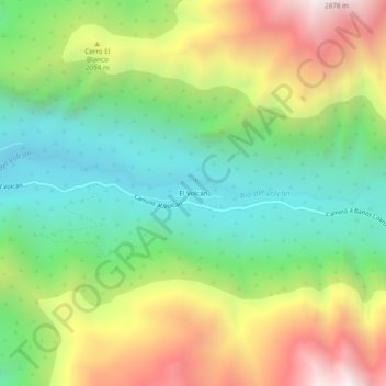
Name: El Volcán topographic map, elevation, terrain.
Average elevation: 1,911 m
Minimum elevation: 1,344 m
Maximum elevation: 2,789 m
Thank you for supporting this site ❤️
Make a donation
Make a donation
Gear up for your next adventure:
As an Amazon Associate, this site earns from qualifying purchases at no extra cost to you.
Other topographic maps
Click on a map to view its topography, its elevation and its terrain.
Humedal Urbano y RENAMU Baños Morales
Chile > Región Metropolitana de Santiago > Provincia de Cordillera > San José de Maipo > Baños Morales
Average elevation: 2,088 m
Laguna El Relvo
Chile > Región Metropolitana de Santiago > Provincia de Cordillera > San José de Maipo
Average elevation: 3,730 m