Geolocate

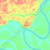
Nhamundá topographic map

Click on the map to display elevation.

About this map

Name: Nhamundá topographic map, elevation, terrain.

Location: Nhamundá, Região Geográfica Imediata de Parintins, Região Geográfica Intermediária de Parintins, Amazonas, North Region, Brazil (-2.42600 -59.19300 0.26400 -56.09700)

Average elevation: 138 m

Minimum elevation: -1 m

Maximum elevation: 532 m

Other topographic maps

Click on a map to view its topography, its elevation and its terrain.

Japura

Brazil > Amazonas > Ipixuna

Average elevation: 157 m

Curua

Brazil > Amazonas > Silves

Average elevation: 22 m

Pauini

Brazil > Amazonas > Pauini > Pauini

Average elevation: 96 m

Gear up for your next adventure:

🩹Compact First Aid Kit - Pre-packed essentials for common trail injuries
🔨Vehicle Emergency Tool - Safety tool for remote road trips to trailheads
🧢Hiking Hat - Sun-protective and breathable hats for long treks
🧥Waterproof Jacket - Lightweight rain jackets for hiking and outdoor activities
🧭Orienteering Kit - Tools for map reading and navigation in the wild

As an Amazon Associate, this site earns from qualifying purchases at no extra cost to you.