
Baripada topographic map
Click on the map to display elevation.
Baripada
Baripada is at 21°56′N 86°43′E / 21.94°N 86.72°E / 21.94; 86.72. It has an average elevation of 36 metres (118 feet). The city lies along the Budhabalanga River.
About this map
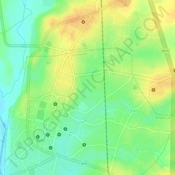
Name: Baripada topographic map, elevation, terrain.
Location: Baripada, Baripada (M), Mayurbhanj, Odisha, 757001, India (21.92910 86.72235 21.94789 86.74538)
Average elevation: 42 m
Minimum elevation: 23 m
Maximum elevation: 59 m
Other topographic maps
Click on a map to view its topography, its elevation and its terrain.
Baripada
India > Odisha > Baripada (M)
Baripada is at 21°56′N 86°43′E / 21.94°N 86.72°E / 21.94; 86.72. It has an average elevation of 36 metres (118 feet). The city lies along the Budhabalanga River.
Average elevation: 80 m