
Thank you for supporting this site ❤️
Make a donation
Make a donation
Gear up for your next adventure:
As an Amazon Associate, this site earns from qualifying purchases at no extra cost to you.
Seixas topographic map
Click on the map to display elevation.
Thank you for supporting this site ❤️
Make a donation
Make a donation
Gear up for your next adventure:
As an Amazon Associate, this site earns from qualifying purchases at no extra cost to you.
About this map
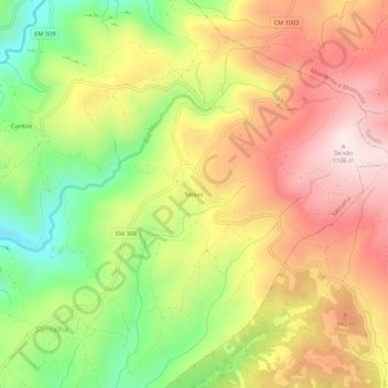
Name: Seixas topographic map, elevation, terrain.
Location: Seixas, Santalha, Vinhais, Bragance, 5320-193, Portugal (41.89727 -7.10513 41.93727 -7.06513)
Average elevation: 827 m
Minimum elevation: 538 m
Maximum elevation: 1,091 m
Thank you for supporting this site ❤️
Make a donation
Make a donation
Gear up for your next adventure:
As an Amazon Associate, this site earns from qualifying purchases at no extra cost to you.