Geolocate

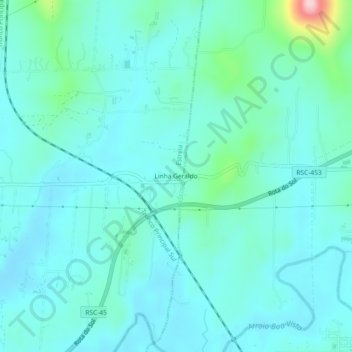
Linha Geraldo topographic map

Click on the map to display elevation.

About this map
Other topographic maps

Click on a map to view its topography, its elevation and its terrain.

Auxiliadora

Brasil > Rio Grande do Sul > Estrela

Average elevation: 37 m

Cristo Rei

Brasil > Rio Grande do Sul > Estrela

Average elevation: 29 m

Boa União

Brasil > Rio Grande do Sul > Estrela

Average elevation: 40 m

Imigrantes

Brasil > Rio Grande do Sul > Estrela

Average elevation: 37 m

Centro

Brasil > Rio Grande do Sul > Estrela

Average elevation: 30 m

Oriental

Brasil > Rio Grande do Sul > Estrela

Average elevation: 32 m

Indústrias

Brasil > Rio Grande do Sul > Estrela

Average elevation: 30 m

Estrela

Brasil > Rio Grande do Sul > Estrela

Average elevation: 47 m

Costão

Brasil > Rio Grande do Sul > Estrela

Average elevation: 68 m

Delfina

Brasil > Rio Grande do Sul > Estrela

Average elevation: 52 m

São José

Brasil > Rio Grande do Sul > Estrela

Average elevation: 32 m

Gear up for your next adventure:

⛺Lightweight Camping Tent - Portable shelter optimized for Canadian backcountry camping
❄️Traction Ice Cleats - Slip-on spikes for icy trails and winter hiking
🛁Quick-Dry Microfiber Towel - Space-saving towel that dries rapidly on the move
🛶Kayak Dry Bag - Waterproof storage for kayaking adventures
🧦Hiking Socks - Moisture-wicking and comfortable socks for long hikes

As an Amazon Associate, this site earns from qualifying purchases at no extra cost to you.