Geolocate

Diana topographic map

Click on the map to display elevation.

About this map

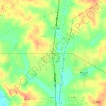
Name: Diana topographic map, elevation, terrain.

Location: Diana, Upshur County, Texas, United States (32.69000 -94.77203 32.73000 -94.73203)

Average elevation: 95 m

Minimum elevation: 69 m

Maximum elevation: 117 m

Other topographic maps

Click on a map to view its topography, its elevation and its terrain.

Gear up for your next adventure:

🧥Softshell Jacket - Windproof and breathable jacket for hiking
🧥Packable Rain Jacket - Breathable waterproof layer for unpredictable weather
🧦Hiking Liner Socks - Thin base layer to prevent friction and blisters
🔭Compact Monocular - One-handed bird watching and trail spotting
🔦LED Headlamp - Hands-free lighting for early morning starts or late finishes

As an Amazon Associate, this site earns from qualifying purchases at no extra cost to you.