Geolocate

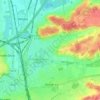
Herent topographic map

Click on the map to display elevation.

About this map

Name: Herent topographic map, elevation, terrain.

Location: Herent, Leuven, Flemish Brabant, Flanders, 3020, Belgium (50.88537 4.64540 50.93598 4.70249)

Average elevation: 29 m

Minimum elevation: 10 m

Maximum elevation: 92 m

Other topographic maps

Click on a map to view its topography, its elevation and its terrain.
Leuven

Belgium > Flemish Brabant > Leuven > Leuven

Average elevation: 50 m

Bos

Belgium > Flemish Brabant > Leuven > Zoutleeuw

Average elevation: 31 m

Orsmaal

Belgium > Flemish Brabant > Leuven

Average elevation: 44 m

Optielt

Belgium > Flemish Brabant > Leuven > Tielt

Average elevation: 51 m

Butsel

Belgium > Flemish Brabant > Leuven > Boutersem

Average elevation: 66 m

Beneden-Kessel

Belgium > Flemish Brabant > Leuven > Leuven > Kessel-Lo

Average elevation: 34 m

Ourodenberg

Belgium > Flemish Brabant > Leuven > Aarschot

Average elevation: 16 m

Stadspark

Belgium > Flemish Brabant > Leuven > Aarschot

Average elevation: 24 m

Gear up for your next adventure:

🔦LED Headlamp - Hands-free lighting for early morning starts or late finishes
🚲Bike Repair Kit - Essential tools for on-trail mechanical issues
🧢Hiking Hat - Sun-protective and breathable hats for long treks
🧢Outdoor Cap - Protective cap for sun and rain during hikes
🕶️Polarized Sunglasses - Protect your eyes with durable polarized lenses

As an Amazon Associate, this site earns from qualifying purchases at no extra cost to you.