Geolocate

Biblis topographic map

Click on the map to display elevation.

About this map

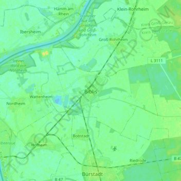
Name: Biblis topographic map, elevation, terrain.

Location: Biblis, Kreis Bergstraße, Hesse, 68647, Germany (49.66044 8.35472 49.71668 8.51169)

Average elevation: 90 m

Minimum elevation: 84 m

Maximum elevation: 104 m

Gear up for your next adventure:

🧢Hiking Sun Hat - Wide-brimmed protection for exposed mountain ridges
Camping Coffee Maker - Brew fresh coffee anywhere on the topographic map
🛶Kayak Accessories - Essential gear for safe and fun kayaking adventures
❄️Traction Ice Cleats - Slip-on spikes for icy trails and winter hiking
🥾Lightweight Hiking Boots - Boots for comfort and mobility on long hikes

As an Amazon Associate, this site earns from qualifying purchases at no extra cost to you.