
Thank you for supporting this site ❤️
Make a donation
Make a donation
Gear up for your next adventure:
As an Amazon Associate, this site earns from qualifying purchases at no extra cost to you.
Buckhorn topographic map
Click on the map to display elevation.
Thank you for supporting this site ❤️
Make a donation
Make a donation
Gear up for your next adventure:
As an Amazon Associate, this site earns from qualifying purchases at no extra cost to you.
About this map
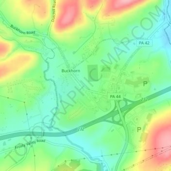
Name: Buckhorn topographic map, elevation, terrain.
Location: Buckhorn, Columbia County, Pennsylvania, United States (41.00939 -76.50606 41.02436 -76.48431)
Average elevation: 197 m
Minimum elevation: 148 m
Maximum elevation: 278 m
Thank you for supporting this site ❤️
Make a donation
Make a donation
Gear up for your next adventure:
As an Amazon Associate, this site earns from qualifying purchases at no extra cost to you.
Other topographic maps
Click on a map to view its topography, its elevation and its terrain.
Hemlock Creek
United States > Pennsylvania > Columbia County > Buckhorn > Buckhorn
Average elevation: 207 m