Geolocate

Van Wert topographic map

Click on the map to display elevation.

About this map

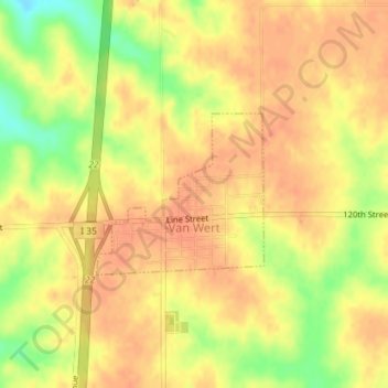
Name: Van Wert topographic map, elevation, terrain.

Location: Van Wert, Decatur County, Iowa, United States (40.86643 -93.80205 40.87765 -93.78658)

Average elevation: 346 m

Minimum elevation: 316 m

Maximum elevation: 358 m

Gear up for your next adventure:

🦯Trekking Poles - Reduced impact on joints for steep topographic climbs
🥾Mountaineering Boots - Supportive boots for climbing and high-altitude hiking
❄️Traction Ice Cleats - Slip-on spikes for icy trails and winter hiking
🥾Trekking Boots - Durable boots for long-distance trekking
🍽️Titanium Camping Spork - Ultralight and indestructible eating utensil

As an Amazon Associate, this site earns from qualifying purchases at no extra cost to you.