Geolocate

Pelham Gate topographic map

Click on the map to display elevation.

About this map

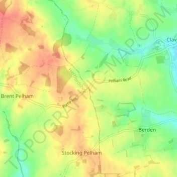
Name: Pelham Gate topographic map, elevation, terrain.

Location: Pelham Gate, Brent Pelham, East Hertfordshire, Hertfordshire, England, SG9 0HL, United Kingdom (51.93636 0.09424 51.97636 0.13424)

Average elevation: 113 m

Minimum elevation: 84 m

Maximum elevation: 141 m

Other topographic maps

Click on a map to view its topography, its elevation and its terrain.

Gear up for your next adventure:

🚲Heavy Duty Bike Lock - Secure your bike at the trailhead or during stops
🧊Portable Cooler - Keep food and drinks cold during outdoor adventures
🥾Light Hiking Boots - Lightweight and comfortable boots for day hikes
🪜Heavy Duty Carabiners - Multi-use clips for securing gear to your backpack
🦶Anti-Blister Balm - Prevents friction and hotspots during long ascents

As an Amazon Associate, this site earns from qualifying purchases at no extra cost to you.