
Make a donation
Gear up for your next adventure:
As an Amazon Associate, this site earns from qualifying purchases at no extra cost to you.
Valls topographic map
Click on the map to display elevation.
Make a donation
Gear up for your next adventure:
As an Amazon Associate, this site earns from qualifying purchases at no extra cost to you.
Valls
Commune située à 19 km de Tarragone, c'est la capitale de la comarque d'Alt Camp à 215 m d'altitude.
Make a donation
Gear up for your next adventure:
As an Amazon Associate, this site earns from qualifying purchases at no extra cost to you.
About this map
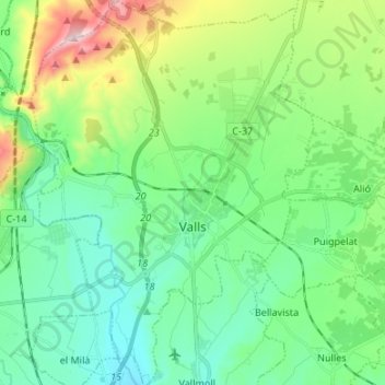
Name: Valls topographic map, elevation, terrain.
Location: Valls, Haute-Campagne, Tarragone, Catalogne, Espagne (41.24206 1.19104 41.34256 1.28952)
Average elevation: 259 m
Minimum elevation: 108 m
Maximum elevation: 688 m
Make a donation
Gear up for your next adventure:
As an Amazon Associate, this site earns from qualifying purchases at no extra cost to you.
Other topographic maps
Click on a map to view its topography, its elevation and its terrain.