
Make a donation
Gear up for your next adventure:
As an Amazon Associate, this site earns from qualifying purchases at no extra cost to you.
Fairfield topographic map
Click on the map to display elevation.
Make a donation
Gear up for your next adventure:
As an Amazon Associate, this site earns from qualifying purchases at no extra cost to you.
Fairfield
Fairfield is located at City 43°20′46″N 114°47′28″W / 43.34611°N 114.79111°W / 43.34611; -114.79111 (43.346000, -114.791159), at an elevation of 5,066 feet (1,544 m) above sea level.
Make a donation
Gear up for your next adventure:
As an Amazon Associate, this site earns from qualifying purchases at no extra cost to you.
About this map
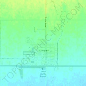
Name: Fairfield topographic map, elevation, terrain.
Location: Fairfield, Camas County, Idaho, 83327, United States (43.34219 -114.81179 43.35666 -114.78696)
Average elevation: 1,546 m
Minimum elevation: 1,539 m
Maximum elevation: 1,555 m
Make a donation
Gear up for your next adventure:
As an Amazon Associate, this site earns from qualifying purchases at no extra cost to you.