Geolocate

Masras topographic map

Click on the map to display elevation.

About this map

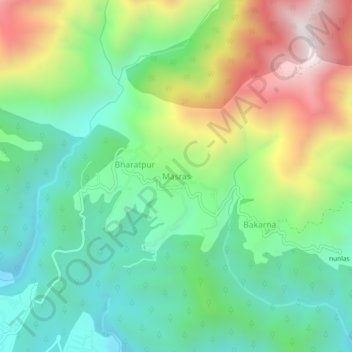
Name: Masras topographic map, elevation, terrain.

Location: Masras, Vikasnagar, Dehradun District, Uttarakhand, India (30.41625 77.96096 30.45625 78.00096)

Average elevation: 1,136 m

Minimum elevation: 757 m

Maximum elevation: 1,847 m

Gear up for your next adventure:

🥫Freeze-Dried Meals - Lightweight, high-calorie nutrition for multi-day treks
🧦Outdoor Socks - Durable socks designed for hiking and outdoor sports
🧢Sun Protection Cap - Breathable cap to protect from sun exposure
🕶️Polarized Sunglasses - Reduces glare from snow and water at high elevations
🥾Lightweight Hiking Boots - Boots for comfort and mobility on long hikes

As an Amazon Associate, this site earns from qualifying purchases at no extra cost to you.