Geolocate

Delfim Moreira topographic map

Click on the map to display elevation.

About this map

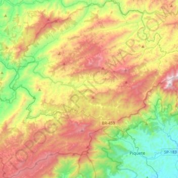
Name: Delfim Moreira topographic map, elevation, terrain.

Location: Delfim Moreira, Microrregião de Itajubá, Mesorregião Sul/Sudoeste de Minas, Minas Gerais, Região Sudeste, 37514-000, Brasil (-22.65368 -45.42035 -22.36877 -45.16324)

Average elevation: 1,315 m

Minimum elevation: 550 m

Maximum elevation: 2,355 m

Other topographic maps

Click on a map to view its topography, its elevation and its terrain.

Serra do Mendanha

Brasil > Minas Gerais > Delfim Moreira

Average elevation: 1,194 m

Biguá

Brasil > Minas Gerais > Delfim Moreira

Average elevation: 1,127 m

Gear up for your next adventure:

🛰️Satellite Messenger - Emergency communication for areas with no cell service
🧴Sunscreen SPF - Broad-spectrum sunscreen for outdoor activities
🥾Trekking Boots - Durable boots for long-distance trekking
🥾Waterproof Hiking Boots - Boots keeping your feet dry in wet conditions
Camping Groundsheet - Protect your tent from moisture and dirt

As an Amazon Associate, this site earns from qualifying purchases at no extra cost to you.