
Thank you for supporting this site ❤️
Make a donation
Make a donation
Gear up for your next adventure:
As an Amazon Associate, this site earns from qualifying purchases at no extra cost to you.
Rayanniyoc topographic map
Click on the map to display elevation.
Thank you for supporting this site ❤️
Make a donation
Make a donation
Gear up for your next adventure:
As an Amazon Associate, this site earns from qualifying purchases at no extra cost to you.
About this map
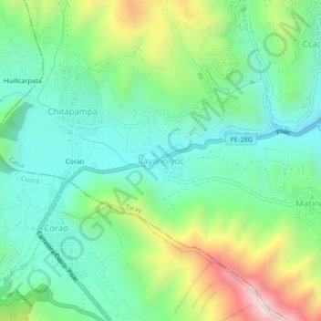
Name: Rayanniyoc topographic map, elevation, terrain.
Location: Rayanniyoc, Taray, Calca, Cusco, Perú (-13.48987 -71.92934 -13.44987 -71.88934)
Average elevation: 3,741 m
Minimum elevation: 3,498 m
Maximum elevation: 4,292 m
Thank you for supporting this site ❤️
Make a donation
Make a donation
Gear up for your next adventure:
As an Amazon Associate, this site earns from qualifying purchases at no extra cost to you.