
Shongum Lake Dam topographic map
Interactive map
Click on the map to display elevation.
About this map
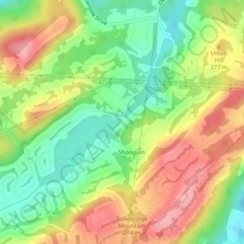
Name: Shongum Lake Dam topographic map, elevation, terrain.
Average elevation: 255 m
Minimum elevation: 199 m
Maximum elevation: 316 m
Other topographic maps
Click on a map to view its topography, its elevation and its terrain.
Lake Cherokee
United States > New Jersey > Morris County > Randolph Township > Calais Crossroads
Lake Cherokee, Calais Crossroads, Randolph Township, Morris County, New Jersey, United States
Average elevation: 295 m
Mill Brook
United States > New Jersey > Morris County > Randolph Township
Mill Brook, Randolph Township, Morris County, New Jersey, 07801, United States
Average elevation: 241 m
Ironia
United States > New Jersey > Morris County > Randolph Township
Ironia, Randolph Township, Morris County, New Jersey, 07876, United States
Average elevation: 260 m
Coleman Hollow
United States > New Jersey > Morris County > Randolph Township > Coleman Hollow
Coleman Hollow, Randolph Township, Morris County, New Jersey, 07845, United States
Average elevation: 263 m