
Thank you for supporting this site ❤️
Make a donation
Make a donation
Gear up for your next adventure:
As an Amazon Associate, this site earns from qualifying purchases at no extra cost to you.
Nordbø topographic map
Click on the map to display elevation.
Thank you for supporting this site ❤️
Make a donation
Make a donation
Gear up for your next adventure:
As an Amazon Associate, this site earns from qualifying purchases at no extra cost to you.
About this map
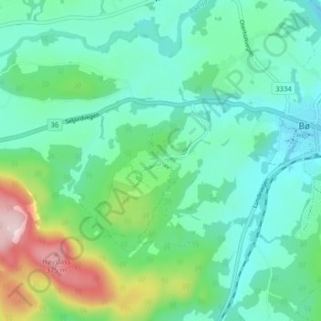
Name: Nordbø topographic map, elevation, terrain.
Location: Nordbø, Bø, Midt-Telemark, Vestfold og Telemark, 3800, Noorwegen (59.38870 9.01138 59.42870 9.05138)
Average elevation: 139 m
Minimum elevation: 59 m
Maximum elevation: 394 m
Thank you for supporting this site ❤️
Make a donation
Make a donation
Gear up for your next adventure:
As an Amazon Associate, this site earns from qualifying purchases at no extra cost to you.