Geolocate

Magnadorsa topographic map

Click on the map to display elevation.

About this map

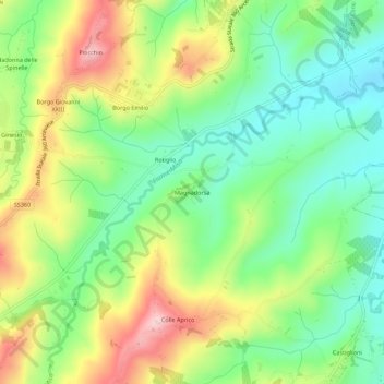
Name: Magnadorsa topographic map, elevation, terrain.

Location: Magnadorsa, Arcevia, Ancona, Marche, 60011, Italy (43.50440 12.96760 43.54440 13.00760)

Average elevation: 231 m

Minimum elevation: 136 m

Maximum elevation: 377 m

Gear up for your next adventure:

🥾Hiking Shoes - Durable and comfortable shoes for trail hiking
🧼Biodegradable Camp Soap - Environmentally friendly cleaning for gear and body
👟Trail Running Shoes - Agile footwear for fast-paced topographic exploration
🥾Trail Hiking Boots - Supportive boots for rough trails
🔦LED Flashlight - Powerful and long-lasting flashlight for camping and emergencies

As an Amazon Associate, this site earns from qualifying purchases at no extra cost to you.