Geolocate

Vamsadhara topographic map

Click on the map to display elevation.

About this map

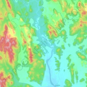
Name: Vamsadhara topographic map, elevation, terrain.

Location: Vamsadhara, Gudari, Rayagada District, Odisha, 765026, India (19.34434 83.70830 19.52909 83.77884)

Average elevation: 304 m

Minimum elevation: 115 m

Maximum elevation: 903 m

Gear up for your next adventure:

🧤Rechargeable Heated Gloves - Extreme warmth for Canadian winter expeditions
🔥Camping Stove - Portable stoves to cook outdoors with ease
🎒Backpack Rain Cover - External shield to keep your entire pack dry
🥾Trail Hiking Shoes - Durable shoes designed for rugged trails
🛶Kayak Dry Bag - Waterproof storage for kayaking adventures

As an Amazon Associate, this site earns from qualifying purchases at no extra cost to you.