
Thank you for supporting this site ❤️
Make a donation
Make a donation
Gear up for your next adventure:
As an Amazon Associate, this site earns from qualifying purchases at no extra cost to you.
Pucará topographic map
Click on the map to display elevation.
Thank you for supporting this site ❤️
Make a donation
Make a donation
Gear up for your next adventure:
As an Amazon Associate, this site earns from qualifying purchases at no extra cost to you.
About this map
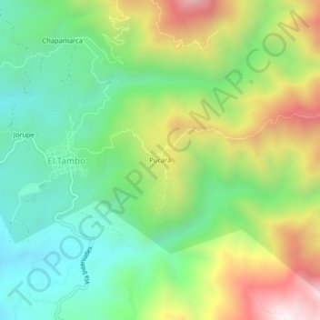
Name: Pucará topographic map, elevation, terrain.
Location: Pucará, El Tambo, Catamayo, Loja, Ecuador (-4.09307 -79.31560 -4.05307 -79.27560)
Average elevation: 1,765 m
Minimum elevation: 1,394 m
Maximum elevation: 2,387 m
Thank you for supporting this site ❤️
Make a donation
Make a donation
Gear up for your next adventure:
As an Amazon Associate, this site earns from qualifying purchases at no extra cost to you.