Geolocate

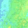
Shady Hills topographic map

Click on the map to display elevation.

About this map

Name: Shady Hills topographic map, elevation, terrain.

Location: Shady Hills, Pasco County, Florida, 34610, United States (28.32924 -82.59765 28.43385 -82.46179)

Average elevation: 18 m

Minimum elevation: 3 m

Maximum elevation: 29 m

Other topographic maps

Click on a map to view its topography, its elevation and its terrain.
Holiday

United States > Florida > Pasco County

Average elevation: 5 m

Odessa

United States > Florida > Pasco County

Average elevation: 16 m

Hudson

United States > Florida > Pasco County

Average elevation: 4 m

Blanton

United States > Florida > Pasco County

Average elevation: 47 m

Seven Oaks

United States > Florida > Pasco County

Average elevation: 20 m

Forest Hills

United States > Florida > Pasco County > Holiday

Average elevation: 4 m

Anclote

United States > Florida > Pasco County

Average elevation: 4 m

Bayonet Point

United States > Florida > Pasco County

Average elevation: 7 m

Elfers

United States > Florida > Pasco County

Average elevation: 5 m

Coquina Key

United States > Florida > Pasco County

Average elevation: 5 m

Gear up for your next adventure:

🥾Waterproof Hiking Shoes - Durable shoes for wet and rugged trails
🧰Survival Kit - Essential gear for emergencies in the wilderness
👟Trail Running Shoes - Agile footwear for fast-paced topographic exploration
🕶️Polarized Sunglasses - Protect your eyes with durable polarized lenses
🥾Trekking Boots - Durable boots for long-distance trekking

As an Amazon Associate, this site earns from qualifying purchases at no extra cost to you.