Geolocate

La Mushca topographic map

Click on the map to display elevation.

About this map

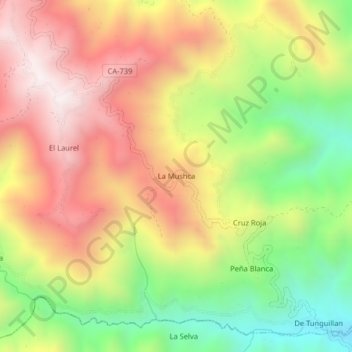
Name: La Mushca topographic map, elevation, terrain.

Location: La Mushca, Las Pirias, Jaén, Cajamarca, Perú (-5.67533 -78.85522 -5.63533 -78.81522)

Average elevation: 1,312 m

Minimum elevation: 812 m

Maximum elevation: 1,780 m

Gear up for your next adventure:

🧦Merino Wool Socks - Moisture-wicking comfort for long-distance hiking
🔨Vehicle Emergency Tool - Safety tool for remote road trips to trailheads
🥤Collapsible Travel Cup - Saves space and weight in your mess kit
🧰Multitool Knife - Compact and versatile tool for outdoor use
🦟Insect Repellent - Keep mosquitoes and black flies away in wooded areas

As an Amazon Associate, this site earns from qualifying purchases at no extra cost to you.