Geolocate

Carbonero topographic map

Click on the map to display elevation.

About this map

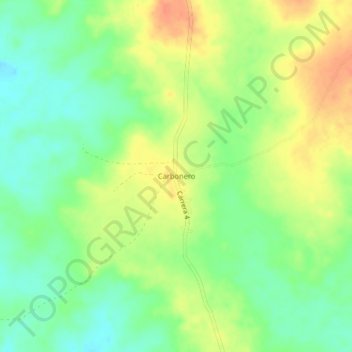
Name: Carbonero topographic map, elevation, terrain.

Location: Carbonero, Chinú, Sabanas, Córdoba, Colombia (8.94402 -75.25586 8.98402 -75.21586)

Average elevation: 58 m

Minimum elevation: 38 m

Maximum elevation: 81 m

Gear up for your next adventure:

🥾Trail Running Shoes - Lightweight and durable shoes for trail running
🧥Softshell Jacket - Windproof and breathable jacket for hiking
🥾Trekking Poles - Adjustable trekking poles to reduce knee stress and improve stability
🔦LED Headtorch - Bright and durable light for night activities
🧼Biodegradable Camp Soap - Environmentally friendly cleaning for gear and body

As an Amazon Associate, this site earns from qualifying purchases at no extra cost to you.