Geolocate

Masquefa topographic map

Click on the map to display elevation.

About this map

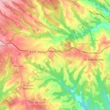
Name: Masquefa topographic map, elevation, terrain.

Location: Masquefa, Anoia, Barcelona, Catalonia, 08783, Spain (41.47287 1.77838 41.52844 1.84505)

Average elevation: 246 m

Minimum elevation: 135 m

Maximum elevation: 342 m

Other topographic maps

Click on a map to view its topography, its elevation and its terrain.

Rofes

Spain > Catalonia > Anoia > la Llacuna

Average elevation: 595 m

Gear up for your next adventure:

🛰️Satellite Messenger - Emergency communication for areas with no cell service
🥾Waterproof Hiking Shoes - Durable shoes for wet and rugged trails
🚲Handlebar Phone Mount - View topographic-map.com live while cycling
Lightweight Backpacking Tent - Compact tent for efficient hiking trips
🧼Travel Hand Sanitizer - Keep hands clean when water is scarce

As an Amazon Associate, this site earns from qualifying purchases at no extra cost to you.