Geolocate

Port Angeles topographic map

Click on the map to display elevation.

About this map

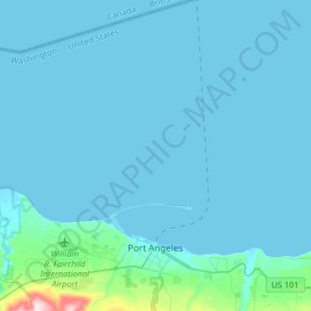
Name: Port Angeles topographic map, elevation, terrain.

Location: Port Angeles, Clallam County, Washington, 98362, United States (48.08357 -123.55910 48.25280 -123.39162)

Average elevation: 27 m

Minimum elevation: -6 m

Maximum elevation: 501 m

Other topographic maps

Click on a map to view its topography, its elevation and its terrain.

Beaver

United States > Washington > Clallam County

Average elevation: 184 m

Ramapo

United States > Washington > Clallam County

Average elevation: 128 m

La Push

United States > Washington > Clallam County

Average elevation: 17 m

Elwha

United States > Washington > Clallam County

Average elevation: 278 m

Quillayute

United States > Washington > Clallam County

Average elevation: 46 m

Agnew

United States > Washington > Clallam County

Average elevation: 54 m

Hoko River

United States > Washington > Clallam County

Average elevation: 207 m

Maple Grove

United States > Washington > Clallam County

Average elevation: 385 m

Elwha

United States > Washington > Clallam County

Average elevation: 278 m

Clallam Bay

United States > Washington > Clallam County

Average elevation: 39 m

Gear up for your next adventure:

🔦LED Flashlight - Powerful and long-lasting flashlight for camping and emergencies
💧Filtered Water Bottle - Safe drinking water on the go
🎒Backpack Rain Cover - External shield to keep your entire pack dry
🦶Hiking Shoe Insoles - Added support for high arches and long days on feet
🧥Thermal Layer - Insulating layer for cold outdoor conditions

As an Amazon Associate, this site earns from qualifying purchases at no extra cost to you.