
Thank you for supporting this site ❤️
Make a donation
Make a donation
Gear up for your next adventure:
As an Amazon Associate, this site earns from qualifying purchases at no extra cost to you.
Acquapagana topographic map
Click on the map to display elevation.
Thank you for supporting this site ❤️
Make a donation
Make a donation
Gear up for your next adventure:
As an Amazon Associate, this site earns from qualifying purchases at no extra cost to you.
About this map
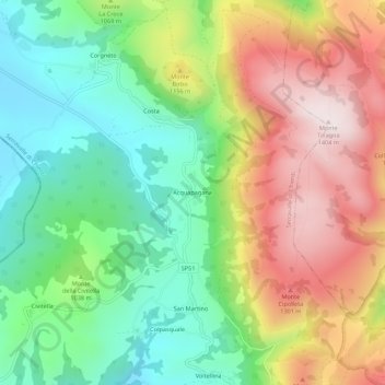
Name: Acquapagana topographic map, elevation, terrain.
Location: Acquapagana, Serravalle di Chienti, Macerata, Italia (42.96445 12.90986 43.00445 12.94986)
Average elevation: 1,045 m
Minimum elevation: 788 m
Maximum elevation: 1,400 m
Thank you for supporting this site ❤️
Make a donation
Make a donation
Gear up for your next adventure:
As an Amazon Associate, this site earns from qualifying purchases at no extra cost to you.