
Thank you for supporting this site ❤️
Make a donation
Make a donation
Gear up for your next adventure:
As an Amazon Associate, this site earns from qualifying purchases at no extra cost to you.
Galbus topographic map
Click on the map to display elevation.
Thank you for supporting this site ❤️
Make a donation
Make a donation
Gear up for your next adventure:
As an Amazon Associate, this site earns from qualifying purchases at no extra cost to you.
About this map
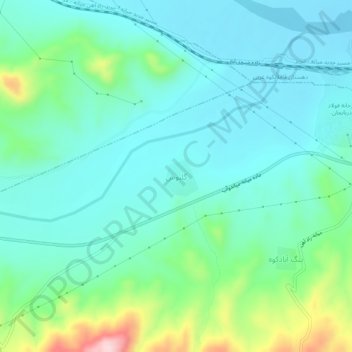
Name: Galbus topographic map, elevation, terrain.
Location: Galbus, دهستان کله بوزشرقی, بخش مرکزی, Mianeh County, Iran (37.34964 47.68855 37.38964 47.72855)
Average elevation: 1,122 m
Minimum elevation: 1,059 m
Maximum elevation: 1,342 m
Thank you for supporting this site ❤️
Make a donation
Make a donation
Gear up for your next adventure:
As an Amazon Associate, this site earns from qualifying purchases at no extra cost to you.