
Make a donation
Gear up for your next adventure:
As an Amazon Associate, this site earns from qualifying purchases at no extra cost to you.
Wegendorf topographic map
Click on the map to display elevation.
Make a donation
Gear up for your next adventure:
As an Amazon Associate, this site earns from qualifying purchases at no extra cost to you.
Wegendorf
Der Ort Wegendorf liegt östlich bis nordöstlich von Berlin im so genannten „engeren Verflechtungsraum“ der Bundeshauptstadt, welcher im Volksmund auch gern als Speckgürtel bezeichnet wird. Geografisch gehört Wegendorf zu der eiszeitlich gebildeten Hochfläche Barnim, die zum Jungmoränenland mit typischen Grundmoränenflächen zählt. Die Höhe variiert je nach Ortslage zwischen 65 und 75 Metern über dem Meeresspiegel. Zum Ortsteil gehört der Wohnplatz Steinau. Ein benachbarter Wohnplatz ebenfalls namens Steinau gehört zu Werneuchen und damit zum Landkreis Barnim.
Make a donation
Gear up for your next adventure:
As an Amazon Associate, this site earns from qualifying purchases at no extra cost to you.
About this map
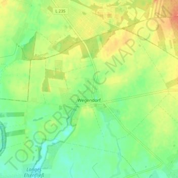
Name: Wegendorf topographic map, elevation, terrain.
Average elevation: 75 m
Minimum elevation: 57 m
Maximum elevation: 95 m
Make a donation
Gear up for your next adventure:
As an Amazon Associate, this site earns from qualifying purchases at no extra cost to you.
Other topographic maps
Click on a map to view its topography, its elevation and its terrain.
Seeberg Dorf
Deutschland > Brandenburg > Märkisch-Oderland > Altlandsberg > Seeberg Dorf
Average elevation: 60 m