
Thank you for supporting this site ❤️
Make a donation
Make a donation
Gear up for your next adventure:
As an Amazon Associate, this site earns from qualifying purchases at no extra cost to you.
Tzununá topographic map
Click on the map to display elevation.
Thank you for supporting this site ❤️
Make a donation
Make a donation
Gear up for your next adventure:
As an Amazon Associate, this site earns from qualifying purchases at no extra cost to you.
About this map
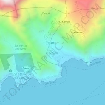
Name: Tzununá topographic map, elevation, terrain.
Location: Tzununá, Santa Cruz La Laguna, Sololá, 07016, Guatemala (14.71331 -91.26679 14.75331 -91.22679)
Average elevation: 1,845 m
Minimum elevation: 1,547 m
Maximum elevation: 2,811 m
Thank you for supporting this site ❤️
Make a donation
Make a donation
Gear up for your next adventure:
As an Amazon Associate, this site earns from qualifying purchases at no extra cost to you.