
Marawi topographic map
Click on the map to display elevation.
Marawi
Marawi is located upon the shores of Lake Lanao.[6] It is primarily inhabited by the Maranao people. The city is also called the "summer capital of the south" due to its higher elevation and cooler climate,[7] a nickname it shares with Malaybalay.[8][better source needed]
About this map
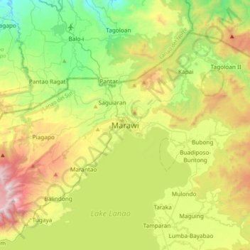
Name: Marawi topographic map, elevation, terrain.
Location: Marawi, Lanao del Sur, Bangsamoro, 9700, Philippines (7.84473 124.12544 8.16473 124.44544)
Average elevation: 707 m
Minimum elevation: 78 m
Maximum elevation: 1,798 m