
Thank you for supporting this site ❤️
Make a donation
Make a donation
Gear up for your next adventure:
As an Amazon Associate, this site earns from qualifying purchases at no extra cost to you.
Alanganallur topographic map
Click on the map to display elevation.
Thank you for supporting this site ❤️
Make a donation
Make a donation
Gear up for your next adventure:
As an Amazon Associate, this site earns from qualifying purchases at no extra cost to you.
About this map
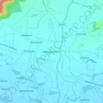
Name: Alanganallur topographic map, elevation, terrain.
Location: Alanganallur, Vadipatti, Madurai, Tamil Nadu, India (10.00636 78.04781 10.08636 78.12781)
Average elevation: 185 m
Minimum elevation: 154 m
Maximum elevation: 661 m
Thank you for supporting this site ❤️
Make a donation
Make a donation
Gear up for your next adventure:
As an Amazon Associate, this site earns from qualifying purchases at no extra cost to you.