Geolocate

Don Mateo topographic map

Click on the map to display elevation.

About this map

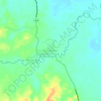
Name: Don Mateo topographic map, elevation, terrain.

Location: Don Mateo, Veruela, Agusan del Sur, Caraga, Philippines (8.07018 125.86903 8.11018 125.90903)

Average elevation: 30 m

Minimum elevation: 17 m

Maximum elevation: 60 m

Gear up for your next adventure:

🔨Vehicle Emergency Tool - Safety tool for remote road trips to trailheads
👟Trail Running Shoes - Agile footwear for fast-paced topographic exploration
🛶Canoe Life Vest - Safety vest for water sports
🧦Merino Wool Socks - Moisture-wicking comfort for long-distance hiking
🕶️Polarized Sunglasses - Protect your eyes with durable polarized lenses

As an Amazon Associate, this site earns from qualifying purchases at no extra cost to you.