Geolocate

Belashtitsa topographic map

Click on the map to display elevation.

About this map

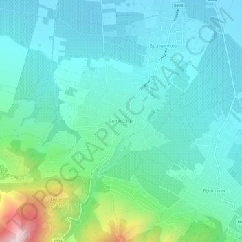
Name: Belashtitsa topographic map, elevation, terrain.

Location: Belashtitsa, Rodopi, Plovdiv, 4124, Bulgaria (42.04580 24.72559 42.08580 24.76559)

Average elevation: 285 m

Minimum elevation: 171 m

Maximum elevation: 752 m

Other topographic maps

Click on a map to view its topography, its elevation and its terrain.

Западен

Bulgaria > Plovdiv > Plovdiv

Average elevation: 172 m

Hisaria

Bulgaria > Plovdiv

Average elevation: 524 m

Южен

Bulgaria > Plovdiv

Average elevation: 173 m

Източен

Bulgaria > Plovdiv

Average elevation: 159 m

Южен

Bulgaria > Plovdiv

Average elevation: 173 m

Централен

Bulgaria > Plovdiv

Average elevation: 168 m

Gear up for your next adventure:

🧭GPS Tracker - Track your location in remote areas safely
🛶Canoe Life Vest - Safety vest for water sports
🦌Outdoor Trail Camera - Monitor wildlife activity near your favorite spots
🦶Hiking Shoe Insoles - Added support for high arches and long days on feet
Lightweight Camping Tent - Portable shelter optimized for Canadian backcountry camping

As an Amazon Associate, this site earns from qualifying purchases at no extra cost to you.