Geolocate

Kepindes topographic map

Click on the map to display elevation.

About this map

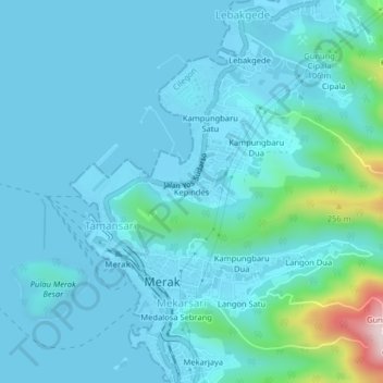
Name: Kepindes topographic map, elevation, terrain.

Location: Kepindes, Tamansari, Cilegon, Banten, Java, 42438, Indonesia (-5.94375 105.98454 -5.90375 106.02454)

Average elevation: 46 m

Minimum elevation: -1 m

Maximum elevation: 403 m

Gear up for your next adventure:

🥾Waterproof Hiking Boots - Boots keeping your feet dry in wet conditions
🥾Lightweight Hiking Boots - Boots for comfort and mobility on long hikes
🥾Hiking Gaiters - Protect legs and shoes from mud, snow, and debris
🔋Solar Power Bank - Keep your GPS and devices charged during long outdoor trips
💡LED Headlamp - Hands-free illumination for night hiking and camping

As an Amazon Associate, this site earns from qualifying purchases at no extra cost to you.