Geolocate

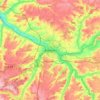
Woincourt topographic map

Click on the map to display elevation.

About this map

Name: Woincourt topographic map, elevation, terrain.

Location: Woincourt, Abbeville, Somme, Hauts-de-France, Metropolitan France, 80520, France (50.04958 1.52650 50.07531 1.55949)

Average elevation: 110 m

Minimum elevation: 78 m

Maximum elevation: 130 m

Other topographic maps

Click on a map to view its topography, its elevation and its terrain.

Petit-Camon

France > Hauts-de-France > Somme > Camon

Average elevation: 73 m

Amiens

France > Hauts-de-France > Somme > Amiens

Average elevation: 86 m

Larronville

France > Hauts-de-France > Somme > Rue

Average elevation: 8 m

Gear up for your next adventure:

🔦LED Flashlight - Powerful and long-lasting flashlight for camping and emergencies
🧤Thermal Hiking Gloves - Grip-enhanced gloves for cold-weather altitude trekking
🧭GPS Outdoor Watch - Smart watch for navigation and fitness tracking in nature
🔥Emergency Fire Starter - Reliable ignition source for all weather conditions
👟Leg Gaiters - Keep debris, mud, and snow out of your boots

As an Amazon Associate, this site earns from qualifying purchases at no extra cost to you.