Geolocate

Cora Cora topographic map

Click on the map to display elevation.

About this map

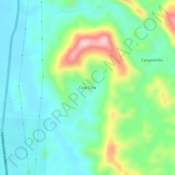
Name: Cora Cora topographic map, elevation, terrain.

Location: Cora Cora, Luyando, Leoncio Prado, Huánuco, Perú (-9.25990 -75.99171 -9.21990 -75.95171)

Average elevation: 696 m

Minimum elevation: 616 m

Maximum elevation: 911 m

Gear up for your next adventure:

🥾Hiking Shorts - Breathable shorts suitable for summer hikes
🧼Biodegradable Camp Soap - Environmentally friendly cleaning for gear and body
🥾Lightweight Hiking Boots - Boots for comfort and mobility on long hikes
💡Portable Camping Lamp - Rechargeable lamp for campsite lighting
👟Leg Gaiters - Keep debris, mud, and snow out of your boots

As an Amazon Associate, this site earns from qualifying purchases at no extra cost to you.