
Make a donation
Gear up for your next adventure:
As an Amazon Associate, this site earns from qualifying purchases at no extra cost to you.
Elfringhauser Schweiz topographic map
Click on the map to display elevation.
Make a donation
Gear up for your next adventure:
As an Amazon Associate, this site earns from qualifying purchases at no extra cost to you.
About this map
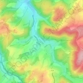
Name: Elfringhauser Schweiz topographic map, elevation, terrain.
Average elevation: 209 m
Minimum elevation: 125 m
Maximum elevation: 308 m
Make a donation
Gear up for your next adventure:
As an Amazon Associate, this site earns from qualifying purchases at no extra cost to you.
Other topographic maps
Click on a map to view its topography, its elevation and its terrain.
N.S.G. Ruhraue Hattingen Winz
Deutschland > Nordrhein-Westfalen > Ennepe-Ruhr-Kreis > Hattingen > Baaker Berg
Das NSG Ruhraue Hattingen-Winz gehört zur naturräumlichen Einheit des Ruhrtals. Im Gebiet gibt es einen Höhenunterschied von 34 Metern. Der höchste Geländepunkt liegt im Osten innerhalb eines rund 4 ha großen Laubmischwaldbereichs am Knäppchen. Den tiefsten Punkt bildet der Wasserspiegel der Ruhr; bei…
Average elevation: 97 m
Make a donation
Gear up for your next adventure:
As an Amazon Associate, this site earns from qualifying purchases at no extra cost to you.