Geolocate

Clyde topographic map

Click on the map to display elevation.

About this map

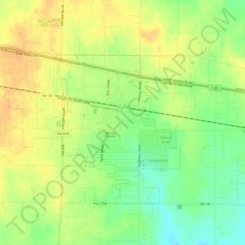
Name: Clyde topographic map, elevation, terrain.

Location: Clyde, Callahan County, Texas, United States (32.38689 -99.53748 32.41886 -99.48035)

Average elevation: 610 m

Minimum elevation: 590 m

Maximum elevation: 624 m

Other topographic maps

Click on a map to view its topography, its elevation and its terrain.

Baird

United States > Texas > Callahan County

Average elevation: 537 m

Gear up for your next adventure:

🌬️Windproof Camp Stove - Efficient cooking even on exposed mountain peaks
🧴Bear Spray Holster - Quick-access carry for essential Canadian wilderness safety
🧥Thermal Fleece Jacket - Versatile insulation for changing mountain temperatures
💧Collapsible Water Bottle - Space-saving water bottle for outdoor activities
🥽Outdoor Goggles - Protective eyewear for outdoor activities

As an Amazon Associate, this site earns from qualifying purchases at no extra cost to you.