Geolocate

Les Sauneries topographic map

Click on the map to display elevation.

About this map
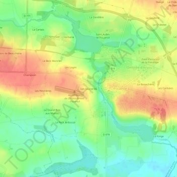
Name: Les Sauneries topographic map, elevation, terrain.

Location: Les Sauneries, Pouancé, Ombrée d'Anjou, Segré, Maine-et-Loire, Pays de la Loire, France métropolitaine, 49420, France (47.72029 -1.20358 47.76029 -1.16358)

Average elevation: 74 m

Minimum elevation: 45 m

Maximum elevation: 105 m

Other topographic maps

Click on a map to view its topography, its elevation and its terrain.

Gear up for your next adventure:

🧦Hiking Socks - Moisture-wicking and comfortable socks for long hikes
🚲Handlebar Phone Mount - View topographic-map.com live while cycling
🚲Heavy Duty Bike Lock - Secure your bike at the trailhead or during stops
🧭GPS Outdoor Watch - Smart watch for navigation and fitness tracking in nature
🧴Sunscreen SPF - Broad-spectrum sunscreen for outdoor activities

As an Amazon Associate, this site earns from qualifying purchases at no extra cost to you.