
Thank you for supporting this site ❤️
Make a donation
Make a donation
Gear up for your next adventure:
As an Amazon Associate, this site earns from qualifying purchases at no extra cost to you.
Ferryville topographic map
Click on the map to display elevation.
Thank you for supporting this site ❤️
Make a donation
Make a donation
Gear up for your next adventure:
As an Amazon Associate, this site earns from qualifying purchases at no extra cost to you.
About this map
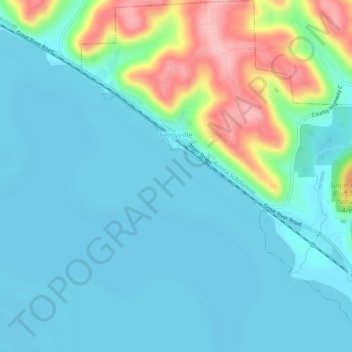
Name: Ferryville topographic map, elevation, terrain.
Location: Ferryville, Crawford County, Wisconsin, United States (43.32758 -91.11581 43.36463 -91.07213)
Average elevation: 220 m
Minimum elevation: 186 m
Maximum elevation: 344 m
Thank you for supporting this site ❤️
Make a donation
Make a donation
Gear up for your next adventure:
As an Amazon Associate, this site earns from qualifying purchases at no extra cost to you.
Other topographic maps
Click on a map to view its topography, its elevation and its terrain.
Kickapoo River State Wildlife Area
United States > Wisconsin > Crawford County > Bell Center
Average elevation: 250 m